Tag Archives: Exeter

Kayaking down the Exeter River

Road map of trip
5122014exetergoogle
Look at trip through Google maps

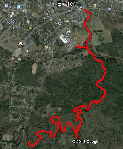
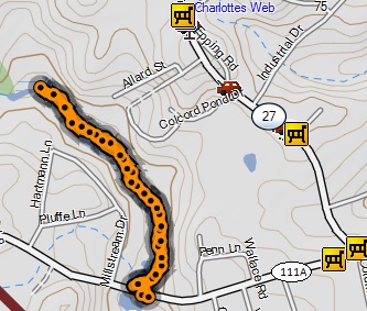
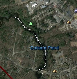
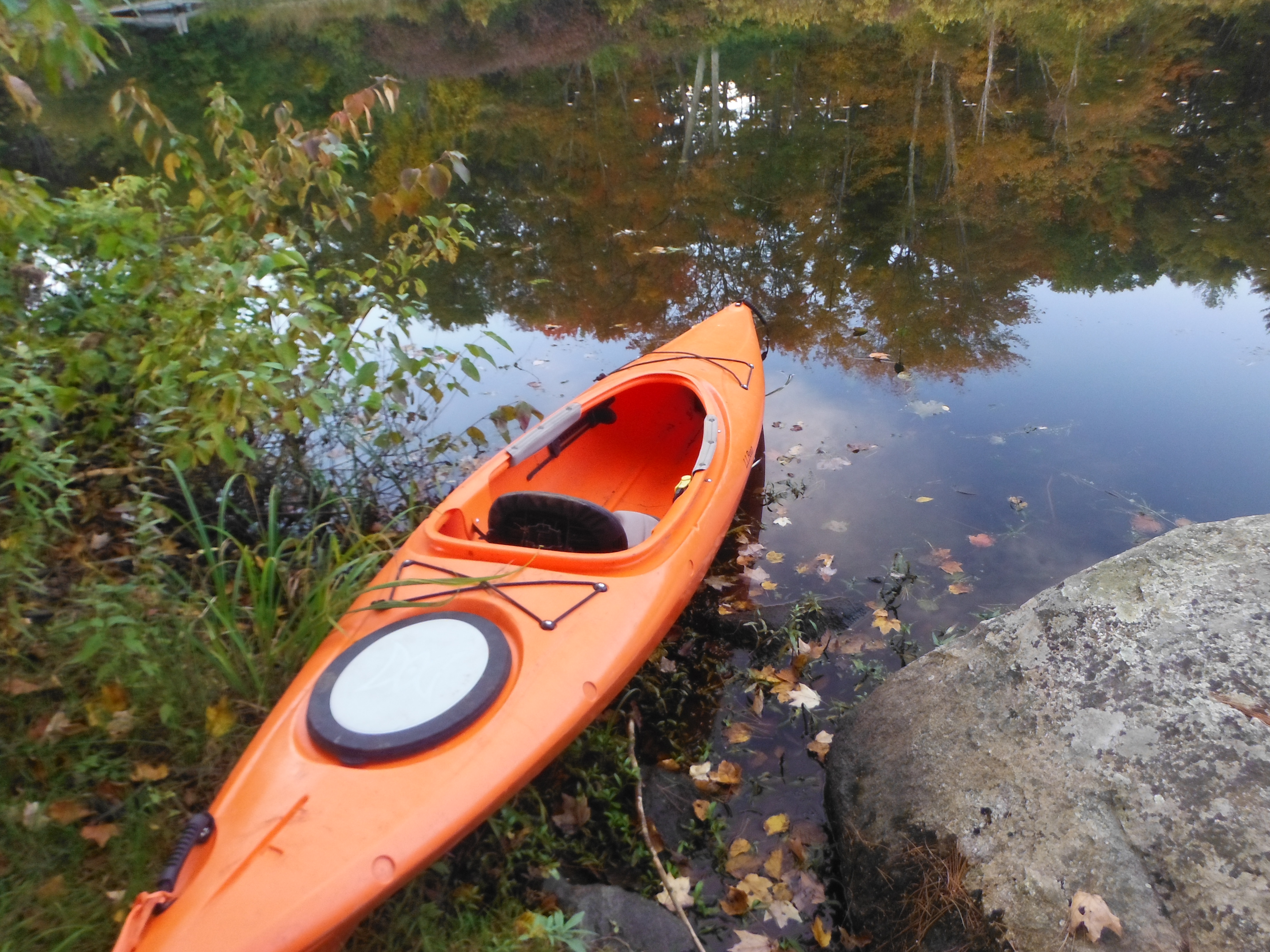
It was a long hard winter.  I was overdue for a kayak adventure.  There was 4 places I set aside for spring time.  3 of the locations are dependent on the tide.  I tried this location last year and found the trail to put in the kayak was covered with poison ivy.    This year there was only a few plants but not overrun like last year.  The kayak needed to be carried about 50 yards until a suitable spot to let in the kayak was found.  As I went into the kayak, I slipped on some mud and got soaked.  My camera, GPS and my cell phone all wet.  They all seemed to still be working so I started my journey.  A side note- the water felt pretty warm even though ice out was only a month earlier.

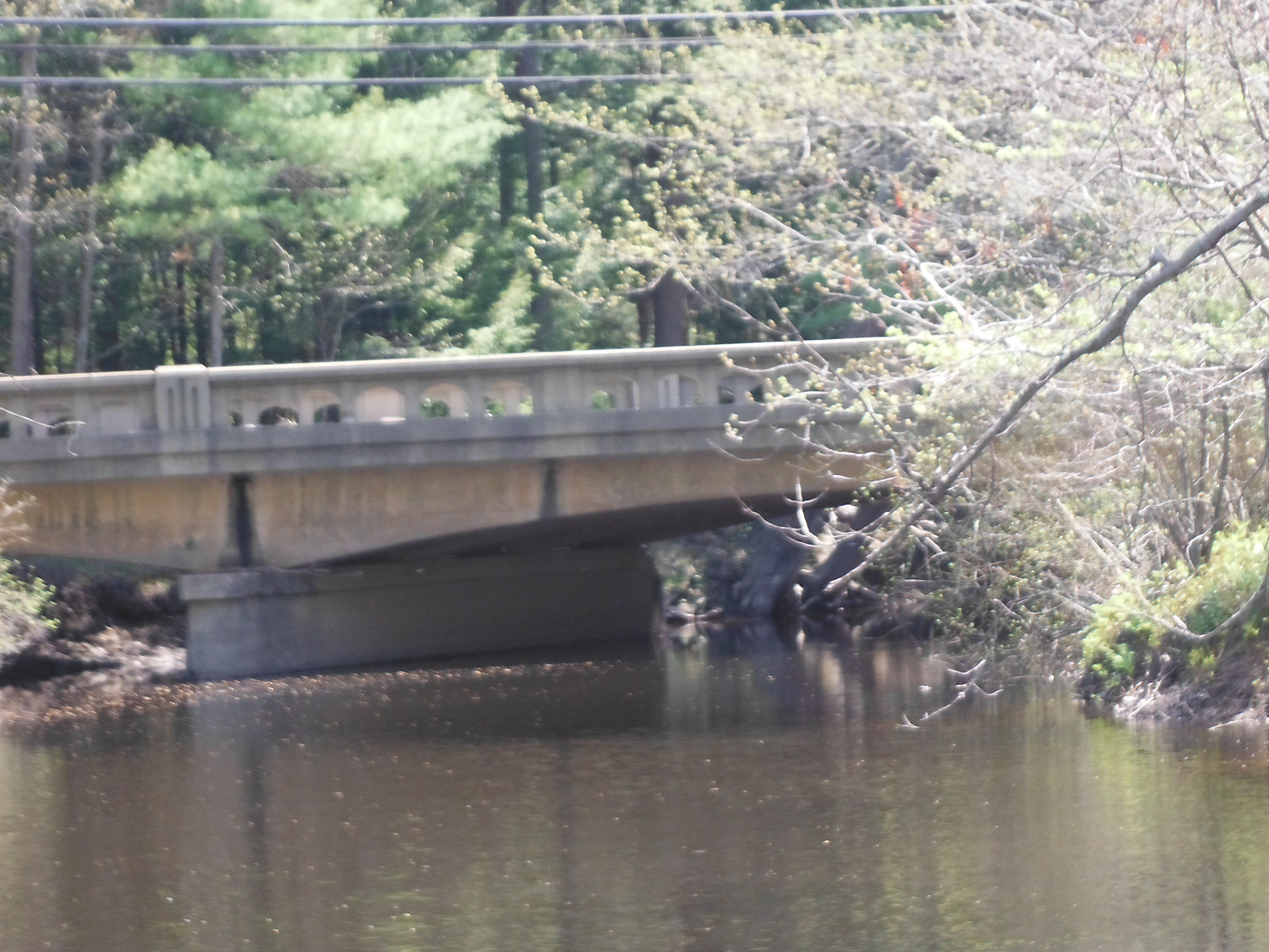
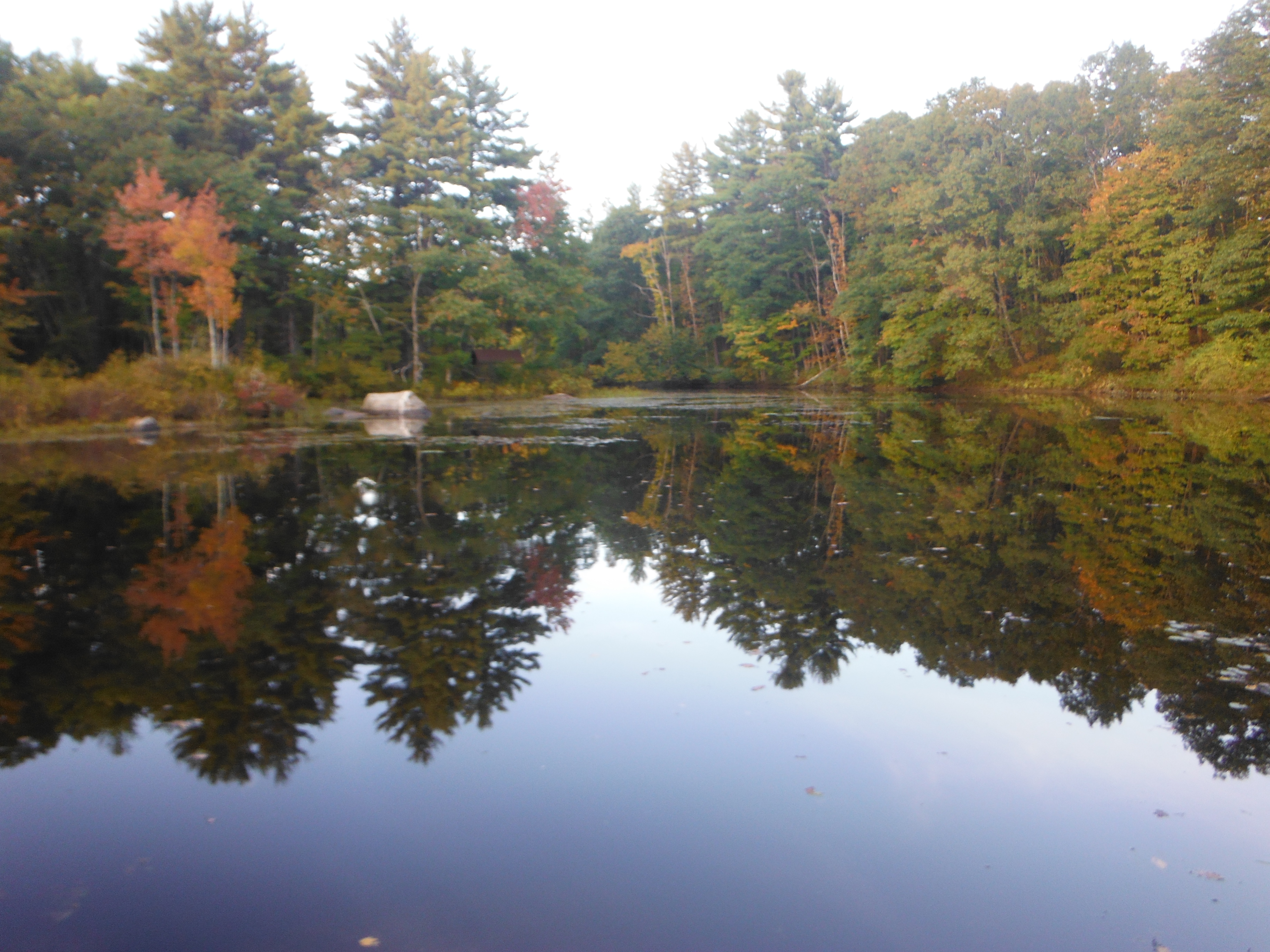
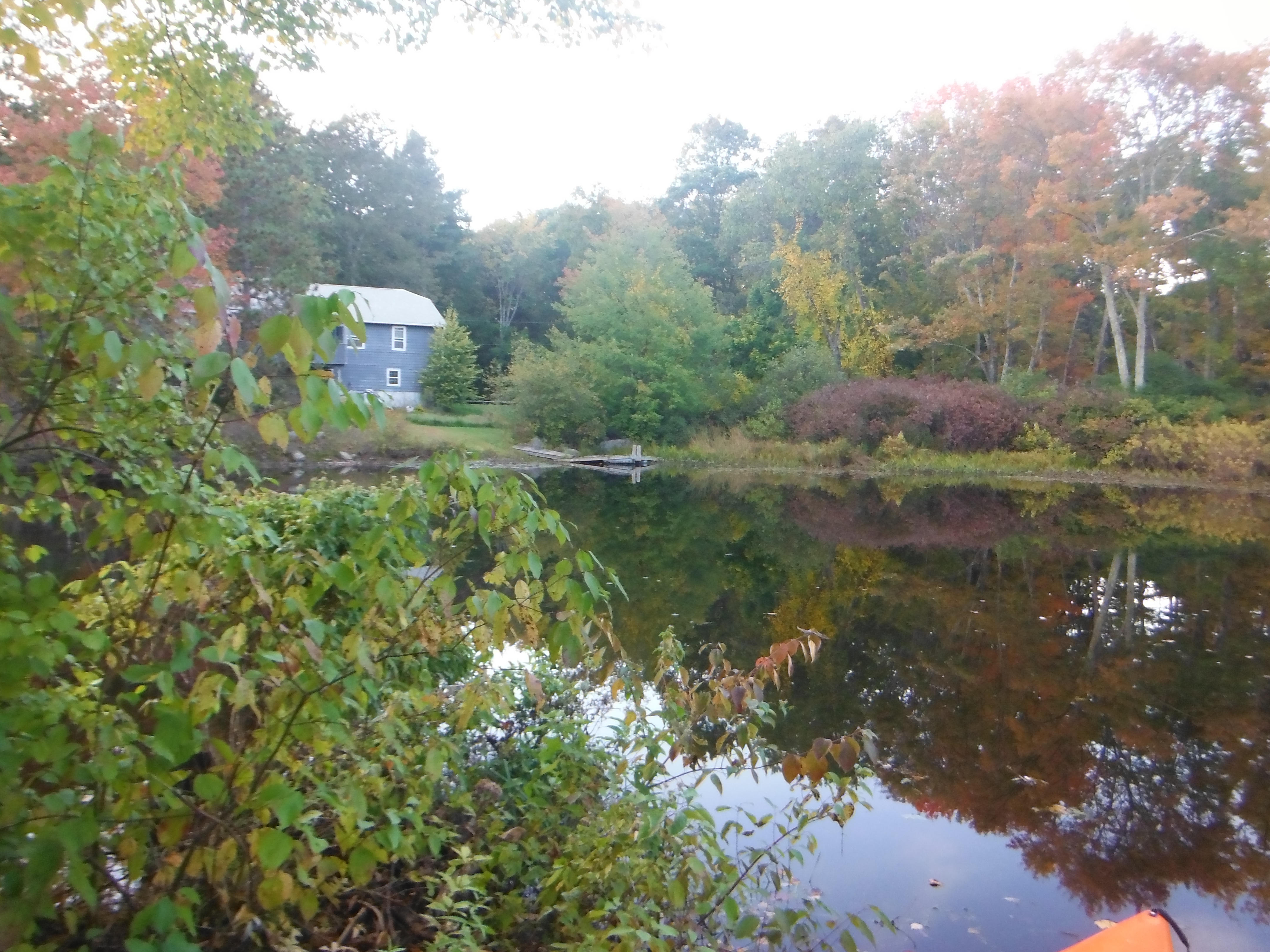
I started down the river.  Although the water level was higher than normal it was still a nice slow pace.   Both sides of the river had character.  Some parts were woodland and some parts were brushes.   On the left I came across a campground.  There were campers even in mid may.  I could smell campfires burning.  It brought back pleasant memories of the times I used to go camping.  One person yelled out saying she wishes she was out on her boat.  As I passed under a large fallen tree another person said they heard a crack indicating the tree was ready to fall even more.

There was a sound of the boat brushing over a log.  The log was a few inches under water where it was hard to see.  I saw an error in my camera.  It seems my waterproof camera had a small leak and water was interfering with its operation.  I opened the battery portion and wiped down the batteries and the memory card.  When the camera was put together it worked flawlessly.  The GPS also started failing.  Kept getting a continual beeping sound.  I did not want to disturb the GPS keeping my progress so I let it keep beeping.  Sure enough at the end of the trip I took the GPS apart, wiped it down and put it back together.  It worked perfectly.  When I downloaded the information into my computer it was like there was any problems.

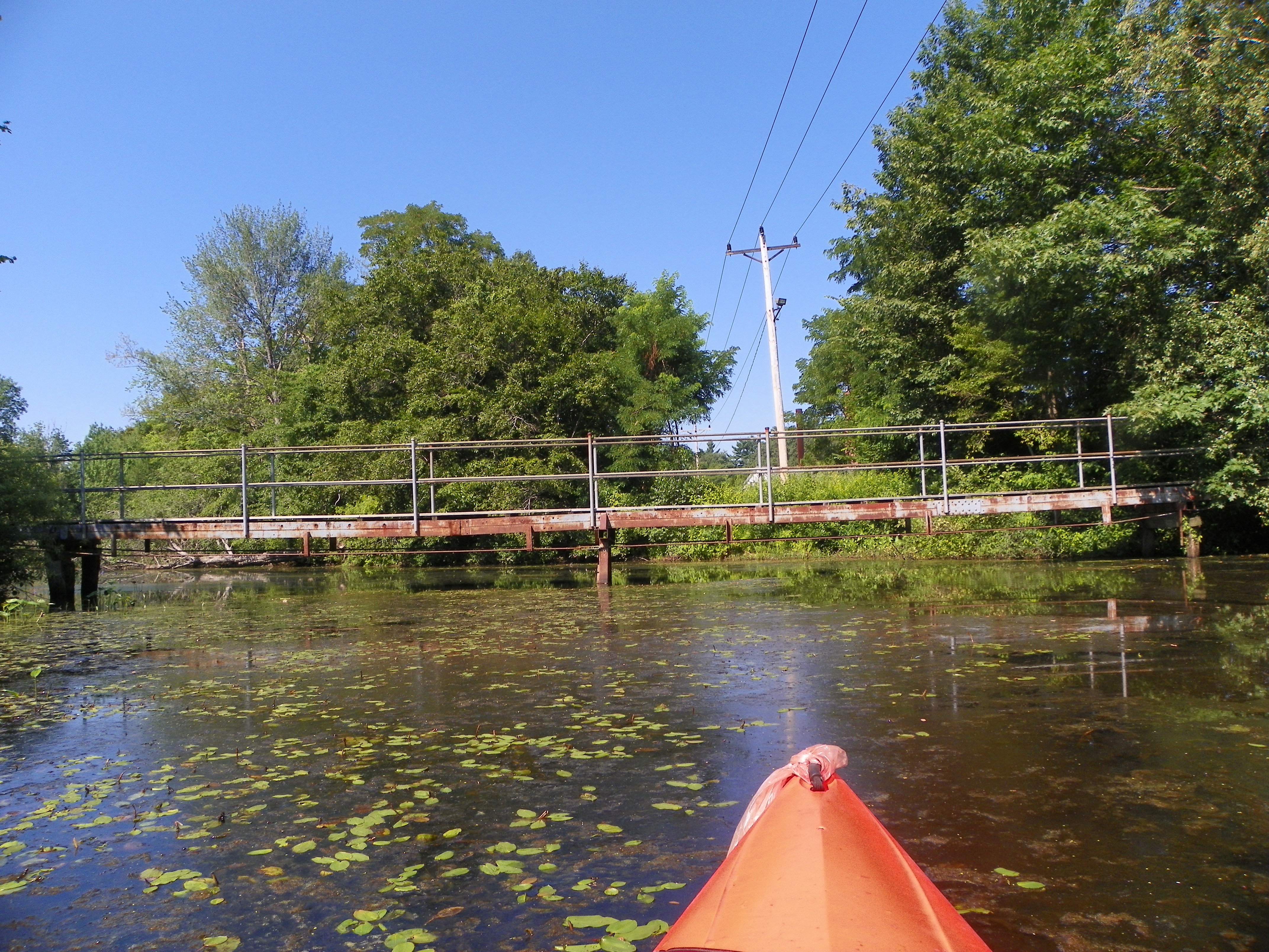
Getting back to the story, I continued my trip down the river until there was blockage preventing me from going further.  I turned around.  The sights were still enjoyable to see on the way back.  The was a pair of ducks going through the brushes.  There were other birds around.  I went past the location where I put the kayak in and was able to go up the river an additional quarter of a mile.  I went back to the location and took the kayak out without incident.   My cell phone will never be the same.

This slideshow requires JavaScript.

DSCF2398 DSCF2399 DSCF2397DSCF2400  DSCF2405 DSCF2407

Gilmore park

Date traveled – August 11, 2011
length of trip – 7.4 miles
weather – sunny, about 70 degrees.
Time on the water-2 hours 47 minutes

aug12011exetergoogle august12011exeter               Gilmore park in Exeter is a good place for a picnic, a walk in the woods, a baseball game and more.  There is two 16th century cannons owned by the federal government and lent to Exeter.  It also has a place where one can launch their boat on the Exeter river.  Looking back I would have taken my GPS equipment with me for there is about a dozen geocache sites that can only be reached from the water.  I launched the boat and went to the town.  I could only go as far as the bridge for route 111.  The dam leading to squamscot river  was immediately downstream of the bridge and getting caught up by the current to the dam would have been disastrous.  From there I went upstream exploring as many inlets as I could.  I went under a foot bridge that Phillip Exeter students use to cross the river.  There were many turtles along the shore sunning themselves on rocks and logs.  They say there are fish there.  I saw no evidence.  There was an unusual looking rock.  When I poked at it, I found that it was a snapping turtle floating in the water and sunning itself.  On the other side , there was a rope hanging from a tree where people swung and jumped into the water.The journey began with the river being wide and stayed wide until the first right and then became narrow.    At that turn straight ahead is a swamp.  Going up the river there was a campground on the left.  I could smell the campfires.  I finally reached the end at a fallen tree going across the river.  I could have made landfall and went around the tree.  I was ready to go back.  There is a place I can get into the water upstream to continue my journey.  I turned around and finally made it back.  I totally enjoyed the trip.

This slideshow requires JavaScript.

rope swing kayaking up river birds watching me Thr end of the journey turtles 100_1072 100_1071 100_1070 100_1069 100_1068 100_1067 100_1066 100_1065

Colcord pond

concold concord103213

Date traveled – October 3, 2013
length of trip – 1.1 miles
weather – cloudy, little breeze, about 60 degrees. Evening sun was going down
Time on the water- .5 hours

This is only a small pond in Exeter NH, fairly close to the center of town.  Documentation says that the average depth is between 2 and 7 feet.  It is more of a fishing area than a place to go boating.  I had a busy day and wasn’t able to start until late afternoon.  This is a small pond created by a dam on Little river.  I did not know how small it was until I kayaked the pond.  For a small pond I saw a number of ducks (about 20 – 30).  When I got there was a parking lot next to the park.  I needed to carry the kayak across the street.  The bridge look too small to go under.  There was very little lake on the parking lot side.  I cross the road and put the kayak into the water.  It was a very relaxing and uneventful trip.  I saw a number of ducks and places where I disturbed the fish by the surface water motion.  There were houses on both sides.  I did not see as many weeds as I expected.  Usually  this late in the season when the water is warm and somewhat stagnate due to the lack of rain.  This creates perfect conditions for the weeds to grow and overrun the pond.  I finish the trip.  I took the kayak out of the water and brought it back to the truck.  It was a short  and enjoyable time.

This slideshow requires JavaScript.

DSCF1851 DSCF1852 DSCF1853 DSCF1854 DSCF1855 DSCF1856

Bridge on route 111A